|
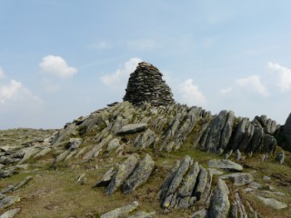
Ill Bell
| Height: |
2,476 feet 755 metres |
 |
| Ranking: |
62 |
| Grid Ref: |
NY 436 077 |
| Map: |
South-eastern Area |
| Book: |
Far Eastern Fells |
|
DATE |
WALK |
DISTANCE |
ASCENT |
TIME TAKEN |
GROUP |
| Sunday, 6th August 2017 |
Ing Lane, Troutbeck Tongue, Park Fell, Thornthwaite Crag, Froswick, Ill Bell, Yoke, Garburn Road (Track), The Howe |
12 mls |
3,600 ft |
6.5 hrs |
Strenuous |
| Sunday, 18th June 2017 |
Garburn Road, Yoke, Ill Bell, Froswick, High Street, Thornthwaite Crag, Threshthwaite Mouth, Park Fell Head for Troutbeck Tongue and Ing Lane for Troutbeck Church |
14.5 mls |
3,650 ft |
7 hrs |
Strenuous |
| Sunday, 6th September 2015 |
Kentmere Horseshoe clockwise via Garburn Pass, Yoke, Ill Bell, Froswick, Thornthwaite Crag, Mardale Ill Bell, Harter Fell(Mardale), Kentmere Pike, Shipman Knotts. |
13 mls |
3,750 ft |
7.25 hrs |
Strenuous |
|
Sunday, 19th May 2013 |
Troutbeck, Broad End for Woundale and St
Ravens Edge, Stony Cove Pike,
Threshthwaite Mouth and Thornthwaite
Crag ( Beacon). Return via Froswick,
Ill Bell, Yoke,
Garburn Road (track) and Limefitt Park. |
13.5 mls |
4,150 ft |
6.5 hrs |
Strenuous |
|
Sunday, 7th August 2011 |
Kentmere, Yoke,
Ill Bell, Froswick,
Mardale Ill Bell, Nan Bield Pass,
Harter Fell,
Kentmere Pike, Shipman Knotts |
12.7 mls |
3,750 ft |
6.25 hrs |
Strenuous |
|
Sunday, 3rd October 2010 |
Garburn Road for Yoke,
Ill Bell, Froswick,
Thornthwaite Crag, Thornthwaite
Mouth & Caudale Moor (Stoney Cove
Pike), Pike How and St Raven`s Edge. At the cairn which overlooks
Kirkstone pass we took the path for Broad End and A592. Crossing the
road at Roundale Raise we headed for Idle Hill and Wansfell Pike
with a final descent to the cars. |
13.5 mls |
4,150 ft |
7 hrs |
Strenuous |
|
Sunday, 25th May
2008 |
Kentmere Horseshoe - Garburn Pass,
Yoke, Ill
Bell, Froswick,
Thornthwaite Crag,
Mardale Ill Bell, Nan Bield Pass,
Harter Fell,
Kentmere Pike,
Shipman Knotts |
12.5 mls |
3,400 ft |
7 hrs |
Strenuous |
Return to Wainwrights List
|