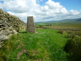




| Height: | 1,358 feet |
|
| Area: | Malhamdale | |
| Grid Ref: | SD 925 632 | |
| Map: | OS Explorer OL2 Yorkshire Dales S & W Areas | |
| Type: | Summit |
|
DATE |
WALK |
DISTANCE |
ASCENT | TIME TAKEN | GROUP |
| Sunday, 31st July 2016 | Leeds & Liverpool Canal, Eshton Road, Flasby, Hetton, Moor Lane (track), Hetton Common, Weets Top, Calton Moor, Calton, Pennine Way, Eshton Moor | 15 mls | 1,800 ft | 6.25 hrs | Strenuous |
| Sunday, 15th February 2015 | Calton Moor, Weets Top, Mastiles Lane and Roman Fort, Malham Cove (top) and Janets Foss. | 12.5 mls | 1,300 ft | 6 hrs | Strenuous |
| Sunday, 1st July 2012 |
St. Michael’s Church, Weet’s Top, Gordale Scar, Gordale Bridge, Street Gate, Malham Tarn, Malham Cove |
16 mls | 2,100 ft | 6.5 hrs | Strenuous |
| Sunday, 22nd August 2010 |
Threshfield: Malham Moor, Mastiles Lane,
Street Gate, Gordale Scar, Weets Top,
Hetton Common and Boss Moor |
15.5 mls | 2,200 ft | 6.5 hrs | Strenuous |
| Sunday, 27th January 2008 | Airton, Far House Laithe, Calton Moor, Weets Top, returning by Winterburn Reservoir |
11.5 mls | 1,600 ft | 5.4 hrs | Strenuous |