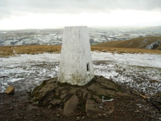




| Height: | 2,218 feet |
|
| Area: | The Howgills | |
| Grid Ref: | SD 667 970 | |
| Map: | OS Explorer OL19 Howgill Fells & Upper Eden Valley | |
| Type: | Summit |
|
DATE |
WALK |
DISTANCE |
ASCENT | TIME TAKEN | GROUP |
| Sunday, 16th July 2017 | Arant Haw, Rowantree Grains Fold, Calders, Bram Rigg Top, The Calf, White Fell Head, Bush Howe, Breaks Head, Wind Scarth and Long Rigg Fold. | 11 mls | 3,200 ft | 5.5 hrs | Strenuous |
| Sunday, 25th November 2012 |
Lockbank Farm, Crosdale Beck, Bram Rigg Beck, White Fell Head, The Calf, Calders, Rowantree Grains, Settlebeck Gill |
9.8 mls | 3,130 ft | 5.75 hrs | Strenuous |
| Sunday, 5th June 2011 |
Knott, Hare Shaw, Blease Fell, Uldale Head, Fell Head, Breaks Head, Bush Howe, The Calf, Hazelgill Knott, Langdale Knott, Longdale |
14 mls | 3,000 ft | 7.5 hrs | Strenuous |
| Sunday, 23rd November 2008 | Bowderdale, Cautley Spout, Cautley Crag, Calders, The Calf, Hazelgill Knott, West Fell |
12.8 mls | 3,100 ft | 6.25 hrs | Strenuous |